
IC-ENC Approves Nigerian Charts As Calabar–Bakassi Axis Joins Global Navigation Network
CYRIACUS IZUEKWE
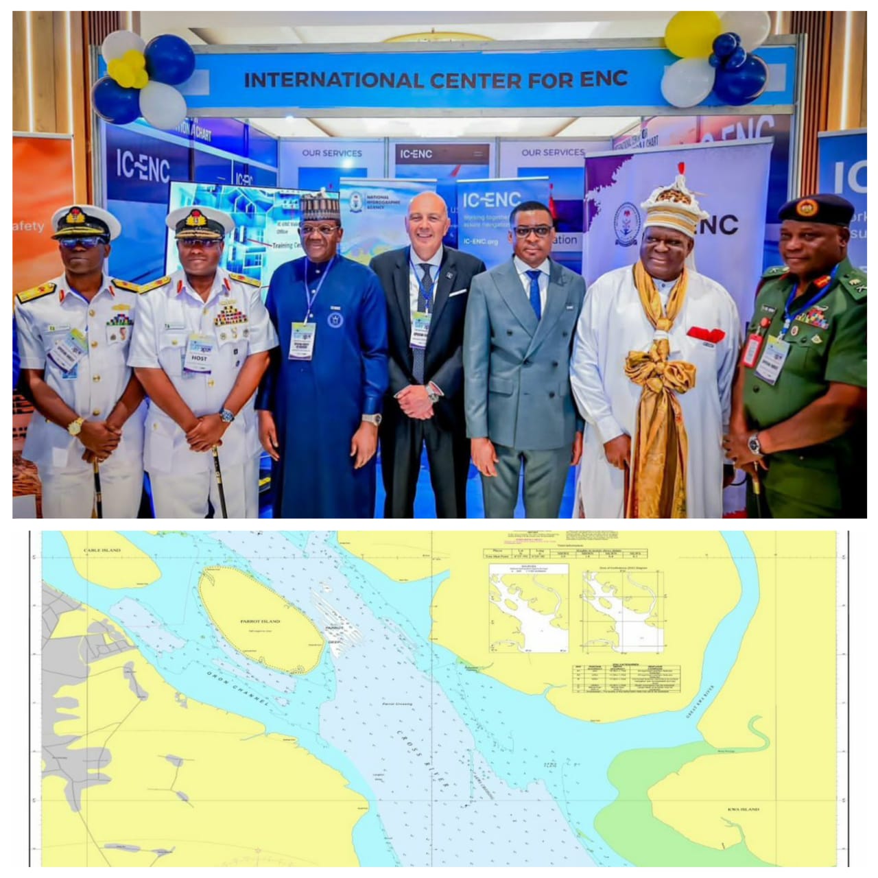
Nigeria has consolidated its role as a regional hydrographic powerhouse with the validation and release of three Electronic Navigational Chart cells for the Calabar–Bakassi axis, expanding safe navigation coverage for vessels accessing Calabar Port and the proposed Bakassi Deep Seaport.
The National Hydrographic Agency announced that the charts—NG455150 (Jamestown), NG525190 (Queenstown to Ikot Abasi), and NG542550 (Ports of Calabar)—have been approved by the International Centre for Electronic Navigational Charts and integrated into global ENC networks used by mariners worldwide.
With the release, all ships navigating Nigeria’s eastern coastal approaches through the inner port limits are required to depend on the newly produced Nigerian ENCs. The charts deliver an integrated digital view of depths, seabed characteristics, navigational hazards, aids to navigation and port infrastructure necessary for safe passage and efficient port operations.
The ENCs were produced following a comprehensive high-resolution survey of the Calabar–Bakassi corridor conducted to international standards comparable to IHO S-44 Order 1. The survey was formally initiated on 21 December 2024, with intensive hydrographic, geophysical and geotechnical data acquisition commencing on 6 January 2025 using advanced NHA survey and processing capabilities.
The Hydrographer of the Federation and Chief Executive Officer of the NHA, Rear Admiral Ayo Olugbode, described accurate hydrographic data as fundamental to maritime safety and economic growth. “The sea is our largest unexplored resource, and if we don’t map it, we can’t manage it,” he said.
Rear Admiral Olugbode stated that chart production for key maritime corridors such as Lagos, Calabar and the Bonny axis remains central to the NHA’s phased national mapping strategy. He disclosed that over 85,325 square kilometres of Nigeria’s maritime domain has already been mapped, with the Calabar sector identified as a critical link in the national ENC network.
The charts replace older legacy products with modern digital navigational tools and directly support the Bakassi Deep Seaport project and Calabar Port operations. The development aligns with President Bola Ahmed Tinubu’s Renewed Hope Agenda and was previously identified by Rear Admiral Olugbode as a core pillar of the President’s blue economy agenda during the 2025 World Hydrography Day and the maiden West African Hydrographic Summit in Abuja.
By combining accurate seabed mapping with training, regional data sharing and the establishment of a new ENC regional office, Nigeria continues to align its hydrographic efforts with the UN Decade of Ocean Science and the Seabed 2030 Initiative, reinforcing safe navigation and long-term growth in maritime revenue.
Related posts